


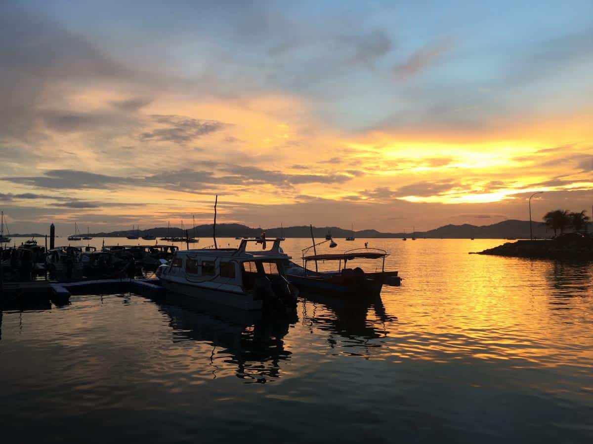
This Malaysian archipelago might not be on everyone’s bucket list, but it appeals especially to the nature lover.
We all know Langkawi for its pristine beaches and duty-free shopping. Known as the Jewel of Kedah, Langkawi is made up of 104 islands with five of them only visible at low-tide. This Malaysian archipelago might not be on everyone’s bucket list, but it appeals especially to the nature lover. Whether you’re looking to kick back and spend a few days here, or sticking around to immerse in the culture of rural Malaysia, Langkawi is an amazing island with lots to offer.
Beyond the usual attractions that we all know about – its cable car, the main beach of Pantai Cenang, cheap alcohol and chocolates, here are some other less populated spots and activities which are just as, if not more attractive than just the usual.
Waterfalls
Langkawi is home to several waterfalls which offer a picturesque and peaceful atmosphere for a picnic or an afternoon of relaxation. However, the water can be quite shallow and slow-moving during the dry season when there is not a lot of rain. The best time to visit these falls would be during the wet season at the year-end, where the waterfalls burst forth with life and stand in their full glory. The best part? They are all free to visit!
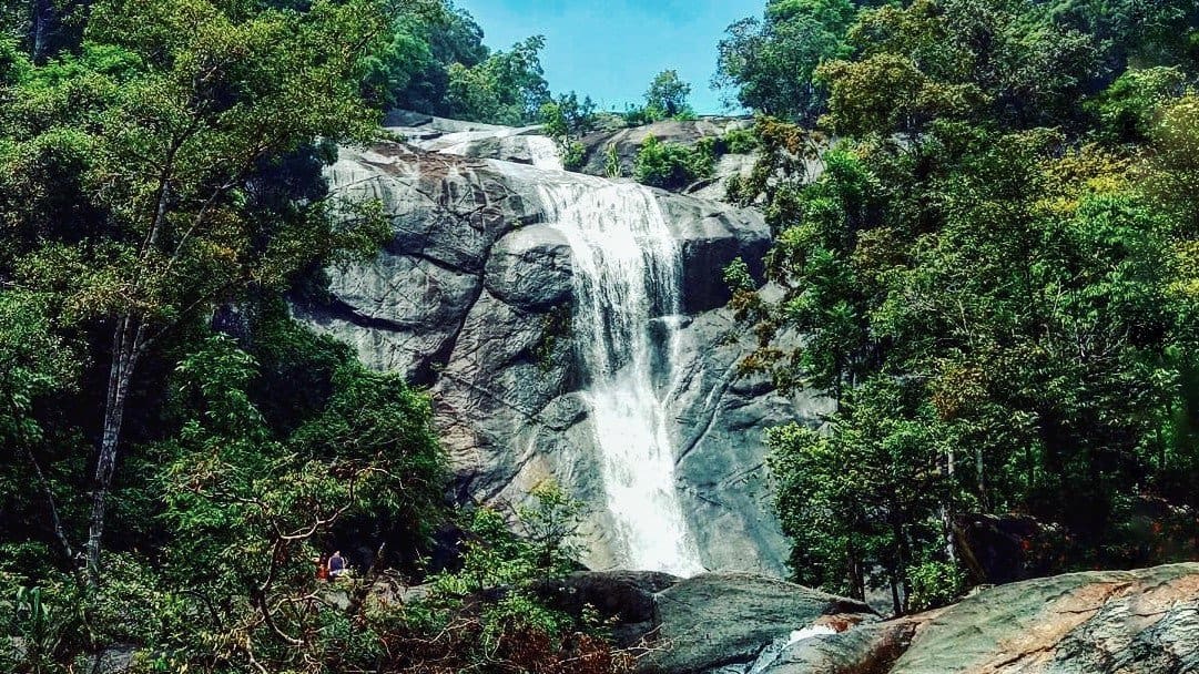
Durian Perangin Waterfall
Named after the durian trees that flourish around the area, Durian Perangin Waterfall sits in the northeastern area of the island surrounded by lush greenery and rock formations. This waterfall has 14 tiers, which means that you can view its different sections from various heights and vantage points. Each section of the falls also has a natural pool where you can choose to take a dip in.
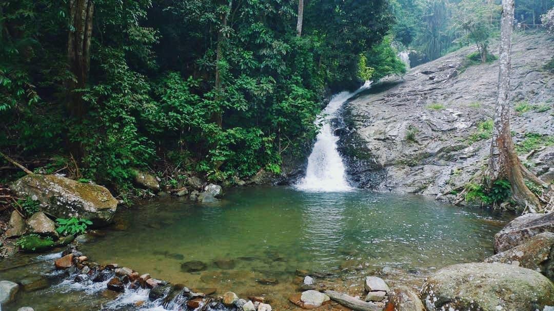
(Author’s own) Lower falls section
At the lower falls section are plenty of gazebos for visitors to take a rest. Local families also seem to like to have their picnics here in the shade. Getting to the top of the falls will require a 10-minute hike. The rock steps are easy to climb, but can get quite steep in some sections. If you have elderly or young children with you, it’s best to stick around the lower falls area that is easily accessible from the carpark area. There are also plenty of facilities such as eateries and small stalls with souvenirs and drinks.
(Author’s own) Upper falls
Getting There: Durian Perangin Waterfall is about 30km away from the main tourist area of Pantai Cenang, north of Kilim Village. Getting around is easy as the main island is small (smaller than Singapore!) The best way to get here is to either hail a taxi or self-drive by renting a car or scooter. If you take a taxi, keep it waiting as you won’t be able to get any transport from here for your return.
If you self-drive, the main roads in Langkawi are well-maintained and numbered with little traffic. From the area of Pantai Cenang, head northwest onto Jalan Pantai Chenang/Route 115. Turn right onto Route 168 where you will come across a roundabout. Take the second exit to Jalan Padang Matsirat/Route 114 and turn left onto Jalan Ulu Melaka/Route 112. From here onwards it’s a straight drive until you come to a second roundabout. Take the third exit to Jalan Ayer Hangat/Route 112. Continue straight, turn right onto Route 162 and you will arrive at the waterfall.
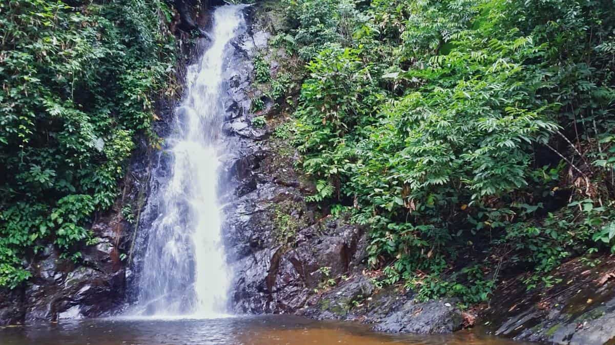
Temurun Waterfall
(Author’s own)
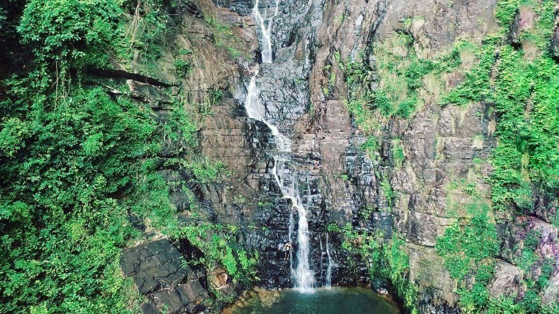
This 3-tier waterfall has a total drop of 200m. As the tallest waterfall in Langkawi, it is truly quite a sight to behold. From the carpark, the lower falls is just a few minutes walk away. However to reach the impressive upper falls and see the waterfall up close, you will have to make a steep upward climb that shouldn’t take more than 10 to 15 minutes.
At the upper falls the water cascades down a height of 30m. The rocky cliffs surrounding it adds to its magnificence and the clear waters in the natural pool is extremely inviting. We even saw some local boys climbing up the cliffs and taking a dive into the pool! So if you’re up for some cliff jumping fun, this is definitely the place to be.
However, do remember that this is a seasonal fall. Outside of the wet season, don’t expect to see the water in its full force. Many visitors in the dry season have been disappointed by a thin stream of water when they expected otherwise. You might also note that there are hardly any facilities here with the exception of a restaurant at the main road, opposite the carpark. Stock up on your food and water if you plan to spend some time here!
Getting There: Located in the Datai Area, Temurun Waterfall is in the northwestern end of island, about 28 km away from Pantai Cenang. Likewise, keep the taxi waiting or you’ll be stranded here.
For self-drivers, head northwest from Pantai Cenang onto Jalan Pantai Chenang/Route 115. Go straight and follow the road until you come to a right turn that takes you onto Jalan Kuala Teriang/Route 114. Then take a left onto Jalan Pantai Kok/Route 114. Follow the road again and turn right onto Jalan Teluk Yu/Route 113. Afterwards turn left onto Jalan Datai/Route 161, go straight and you will arrive at the waterfall.
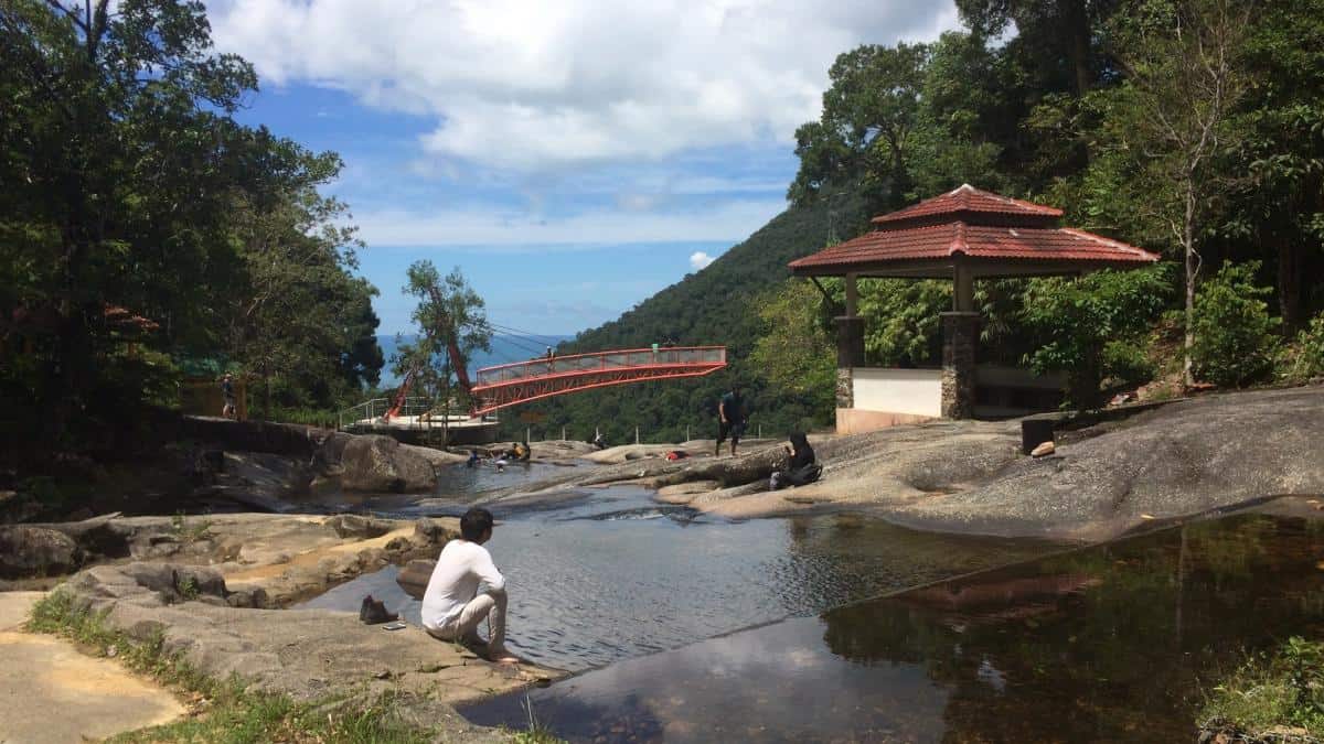
Seven Wells/Telaga Tujuh Waterfall
(Author’s own) Foot of the falls
Telega Tujuh is arguably the most impressive waterfall of them all. Well-known as a natural beauty, “seven wells” is directly in reference to the seven natural pools that make up this stunning attraction. Located in the Pantai Kok area, this waterfall is close to the famous cable cars.
There are two ways to enjoy this waterfall. One is to go to the foot of the falls if you’re not too keen to climb and tire yourself out. From the carpark, take a short uphill climb and take a left turn. Here you can look up at the waterfall cascading down huge rock formations. If you’d like, you can even take a dip at the pools here and cool off before continuing to the top.
To get to the top of the falls will require some tenacity as there a total of 638 steps to climb. Depending on your level of fitness, this can take anywhere from 30 to 45 minutes. Don’t worry, along the way are plenty of benches and gazebos where you can take a break. Bringing some water along with you for the climb will be a wise choice.
(Author’s own) Top of the falls
Once you get to the top, you can see how the water flow has created various rock pools for visitors to wade in. No doubt you’ll be sticky and sweaty by the time to get up here (hello, Southeast Asian humidity), so free feel to hop in and cool off from the heat. At one part, the water has smoothened out the rocks creating a natural water slide. You’ll probably find some kids and even adults having fun here.
From the top, there is a hiking trail that will lead to the top of Mount Mat Cincang. However, this hike is not easy and not meant for the inexperienced (we’ll talk more about this later). Seeing how Telega Tujuh Waterfall requires quite a bit of physical work, this place might not be suitable for elderly or young children.
Getting There: Telega Tujuh is pretty close to Temurun Waterfall, so if you’d like you could visit both waterfalls in a day which was what we did. As with the rest of the waterfalls, keep the taxi running if you hire a cab.
The route to get here is also pretty similar to Temurun Waterfall – head northwest from Pantai Cenang onto Jalan Pantai Chenang/Route 115, follow the road until you come to a right turn onto Jalan Kuala Teriang/Route 114. Then take a left onto Jalan Pantai Kok/Route 114. But instead of taking a right to Jalan Teluk Yu/Route 113, turn left instead to Jalan Telok Burau/Route 113. Continue onto Jalan Telaga Tujuh/Route 272 and at the end of the road is the carpark area of the waterfall.
Beaches
Now that we’ve touched on the waterfalls, we can’t go on about Langkawi without going into its beautiful beaches and hidden gems. Get off the tourist trail! If the populated beaches of Pantai Cenang and Pantai Tengah are not your cup of tea, read on to discover the secluded beaches in Langkawi.
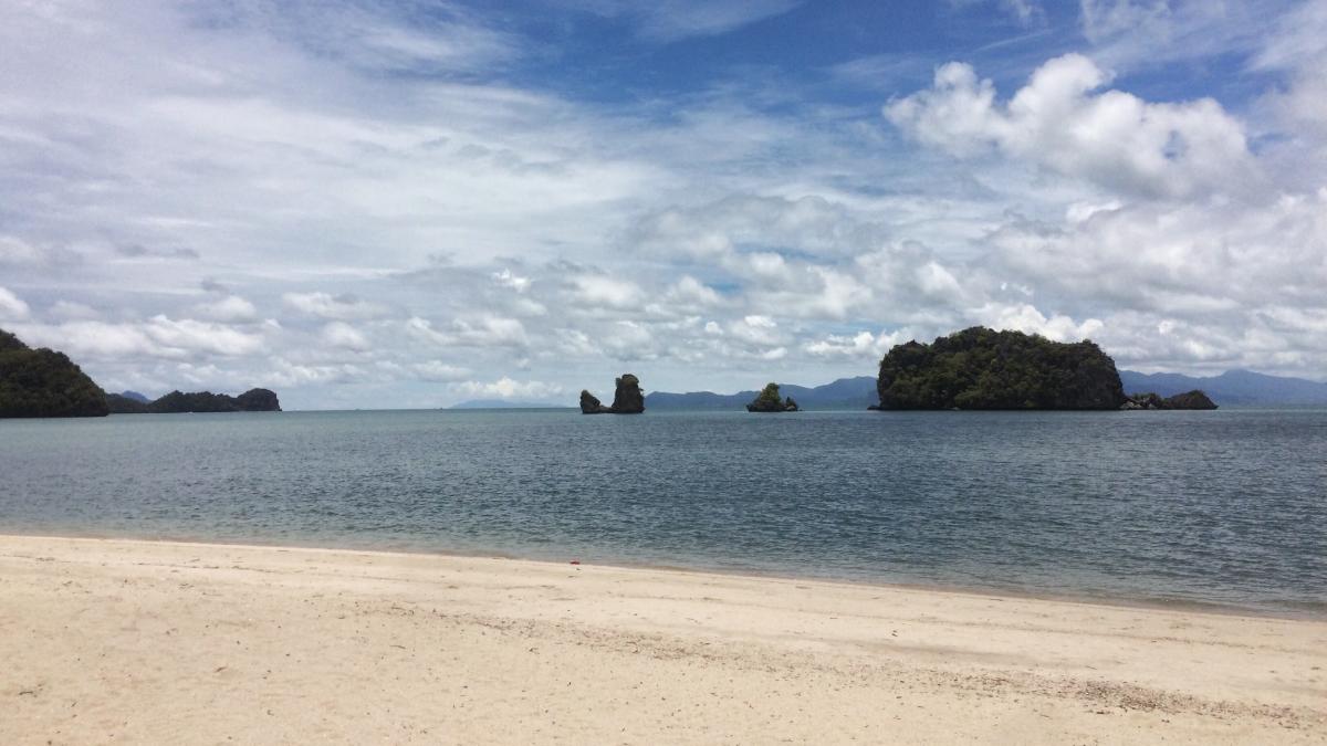
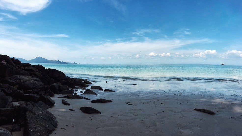
Tanjung Rhu
(Author’s own)
Tanjung Rhu was, hands down, our favourite beach in Langkawi. Located at the northeastern tip of the island, getting there will see you taking a 40-minute ride from the main area of Pantai Cenang. Few tourists are willing to make the long drive here. But for the clear blue water, powdery white sand and secludedness – we’d say it’s very much worth it.
With its long stretch of empty sands, this beautiful place is great for swimming and perfect for an afternoon basking in the sun. Right in front of the beach is a local restaurant where we were served the best food we had in Langkawi (and for a cheap price too!)
Getting There: The route to getting to Tanjung Rhu is somewhat similar to Durian Perangin Waterfall. From Pantai Cenang, head northwest onto Jalan Pantai Chenang/Route 115. Turn right onto Route 168 until you come to a roundabout. Take the second exit to Jalan Padang Matsirat/Route 114 and turn left onto Jalan Ulu Melaka/Route 112. Continue straight until you come to a second roundabout where you will take the second exit to Jalan Tanjung Rhu/Route 111. Go past Four Seasons Resort, you will be on a coastal road leading through a forested area. Continue until you come to end of the road where you will see the beach’s parking area with plenty of booths and shops.
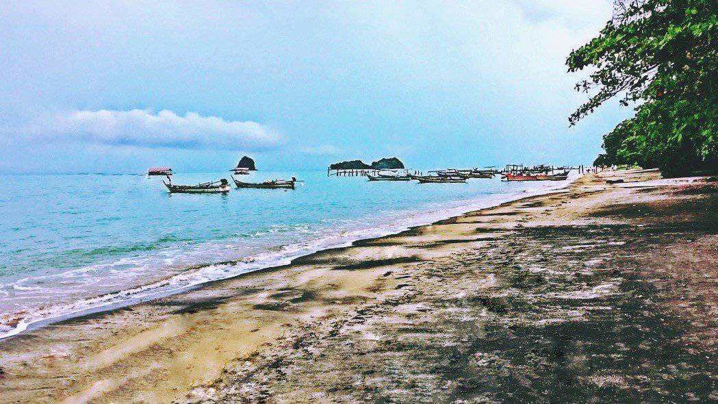
Black Sand Beach
(Author’s own)
Is the sand here really black? Well… Kind of. The beach is not completely black, it looks more like black particles mixed in with the sand. Unlike other islands with black sands caused by volcanic activity, the black sand here is actually caused by minerals. There is a large amount of tourmaline and ilmenite from the granites of Mount Raya. These minerals are washed to the beach by spring water, which causes the “black sand”.
While this beach draws in several visitors for its memorable photo opportunities, it still offers a peaceful getaway from the island’s more crowded areas. Black Sand Beach is part of a traditional fishing village and looking right from the beach, you’ll see a fishing jetty and many fishing boats moored here. The beach is not exactly suitable for swimming and is more often used for picnicking and sunbathing instead. Families with children may also like this place as there is a playground with plenty of swings and slides.
Getting There: By now you might’ve realized that the routes to getting to the various spots in Langkawi are quite similar to one another. As with all the other attractions, head northwest from Pantai Cenang onto Jalan Pantai Chenang/Route 115. Turn right onto Route 168 where you will come to a roundabout. Take the second exit to Jalan Padang Matsirat/Route 114 and turn left onto Jalan Ulu Melaka/Route 112. Continue straight until you come to the second roundabout. Take the first exit onto Jalan Teluk Yu/Route 113. Take a right at the fourth right turn and take a left at the fork to arrive at the beach.
Tengkorak Beach
(Author’s own)
One of the most beautiful and secluded beach in Langkawi, Tengkorak Beach is located in the Datai area. Locally known as Pantai Pasir Tengkorak, it’s literal translation is “sandy skulls beach”. You won’t find any skulls here, but legend has it that a massive storm once wrecked ships passing by the Malacca Strait and the skulls of the dead were washed up ashore.
Ominous stories aside, this place has everything a beach lover needs – trees as shelter, soft white sands and clear blue waters for swimming. You won’t find many foreigners here but this place is a locals’ favourite haunt, especially on weekends and public holidays. There are also many beachfront huts, tables and benches, but they are usually snapped by the local families pretty quickly. Other facilities include toilets, shower rooms and even prayer rooms.
Getting There: The route is exactly the same as getting to Temurun Waterfall – both attractions are in the Datai area. Head to Jalan Pantai Chenang/Route 115. Go straight and follow the road until you come to a right turn that takes you onto Jalan Kuala Teriang/Route 114. Then take a left onto Jalan Pantai Kok/Route 114. Follow the road and turn right onto Jalan Teluk Yu/Route 113, then turn left onto Jalan Datai/Route 161. There will be a short side road on the right that leads to the gate where the beach is. You can see the gate from the main road and the beach is just before Andaman Resort. Further down the road is a tunnel so if you see it you know you’ve gone past your destination.
Mountains
Hiking isn’t usually the first activity that people go for in Langkawi. But if you’re willing to put in the hard work, Mother Nature will issue her rewards accordingly. Not to mention, these hikes are completely free. That’s right, you can climb to the top of Langkawi’s two tallest mountains without a single cent. If we can pass on any advice for these hikes, it is to wear good hiking shoes and bring along lots and lots of water.
Gunung Mat Cincang (Mount Mat Cincang)
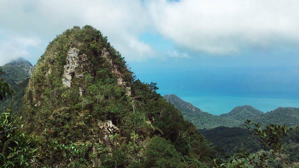
(Author’s own) View from summit of Gunung Mat Cincang
As we mentioned previously, at the top of Telega Tujuh Waterfall or Seven Wells is a hiking trail that leads to the summit of Mount Mat Cincang. This hike is arguably the best kept secret of Langkawi. Cross the river at the very top end of the falls to get to a bench which marks the start of the trail.
At the start, there will be a board that says that the distance to the peak is 980m. That doesn’t sound too far away right? Once you embark on the journey you’ll also find that the first part of the hike isn’t too challenging. But uninformed tourists who are fooled into thinking that this would be an easy hike couldn’t be further away from the truth. After some distance, you will then reach a signboard that warns of the difficult hike ahead. It even tells visitors to make a U-turn if they are unprepared.
Ready to trudge forward? Follow the track to the left and the trail will get quite narrow. Go around a cliff and cross over the loose rocks. When you get to the series of ropes, you will notice that the incline is significantly steeper. These ropes are meant to serve as support for your climb up and they lead all the way to the summit.
You’ll know you’ve reached the top when you come across a green sign that says “Gunung Matcincang, 701m/2300ft”. Here at the peak, you’ll see unrivalled views of Langkawi. Better yet, there’s a good chance you’ll get it all to yourself, since there aren’t many people who attempt this hike (and understandably so). Feel free to revel in a “I am the king/queen of the world!” moment.
All in all, this hike is not meant for the faint-hearted. It is a full body workout that will see you using both upper and lower body strength. Also note that this hike is only suitable in the dry season, as the trail gets slippery when there’s rain. You’ll take at least two to three hours for the hike up and another two hours to come back down (not including the time you’ll take to climb up and down the waterfall). Hopping into the natural pools at Seven Wells after your descent will be a sweet relief. Take some time to relax your body now – you’re sure to ache over the next few days.
Getting There: Since the trail starts at the top of Telega Tujuh Waterfall, simply follow the same directions above to get to the hiking trail.
Gunung Raya (Mount Raya)
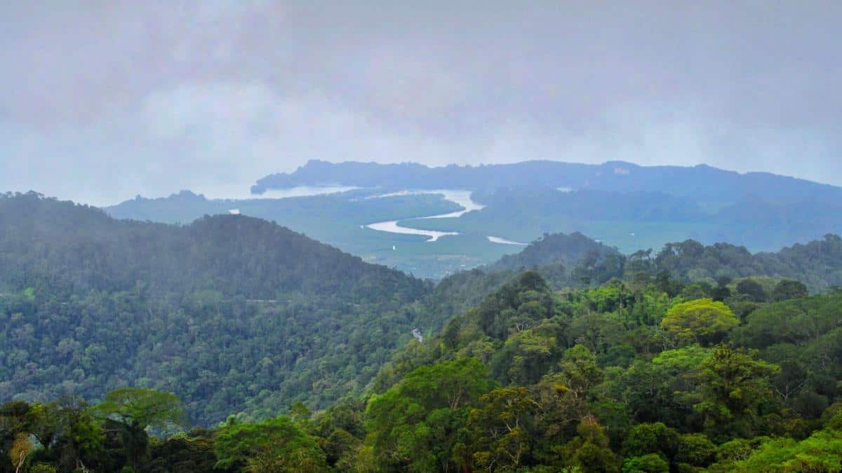
(Author’s own) View from summit of Gunung Raya
Standing at 881m above ground, Gunung Raya is the tallest mountain in Langkawi. With the trail made up of 4287 concrete steps, this hike is much less challenging as compared to Gunung
Mat Cincang. However, in our opinion the view from Gunung Raya is less impressive than its counterpart. If you intend to take on both hikes, we’d suggest to do Gunung Raya first so you won’t be disappointed. Also, it provides a great training ground to prepare you for the arduous hike at Gunung Mat Cincang.
Unlike Gunung Mat Cincang, you can undertake this hike even if it’s a bit rainy since the concrete steps are well-built with railings at the side. Its incline is also manageable although it gets steeper as you go along. This hike should take you about two to two and a half hours going up and one hour down, depending on your level of fitness.
It’s not the end of the trail yet when you get to the top of the stairs. Turn left and follow along a paved path to get to the viewpoint of Gunung Raya. There’s a viewing tower here where you can see the view from an even higher vantage point for 20 RM. We should also mention that unlike Gunung Mat Cincang, you might not get this place all to yourself since its summit is also accessible by car. And if you want to avoid all the hard work, take a transport here instead.
Getting There: The trail start from Lubuk Semilang Recreational Park. To get here, head to Jalan Pantai Chenang/Route 115 and continue towards Jalan Kedawang/Route 116. Take a right turn to Jalan Chandekura/Route 116, another right onto Jalan Padang Matsirat/Route 112, and then left onto Jalan Simpang Kenyum/Route 119. Continue straight until the end of the road where you will take a right turn to Jalan Ulu Melaka/Route 112. Finally, turn right onto Jalan Padang Gaong/Route 152 and you will arrive at the Recreational Park.
If you would like to get to the summit by car instead, you would go the same way as above except at Jalan Ulu Melaka/Route 112. Do not turn right onto Jalan Padang Gaong/Route 152. Instead go straight and turn right only at Jalan Gunung Raya/Route 278. Follow the winding road to reach the summit.


